
Spanish River Railway Bridge 1884
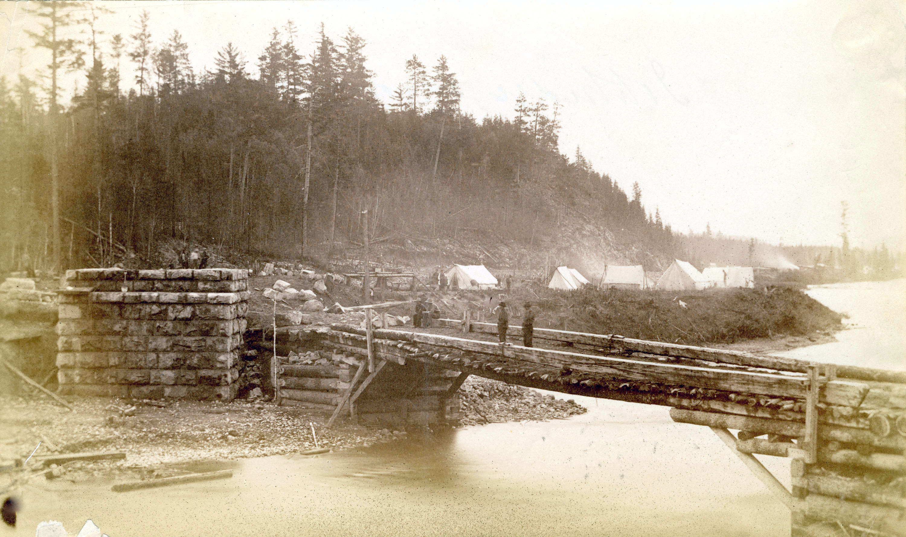
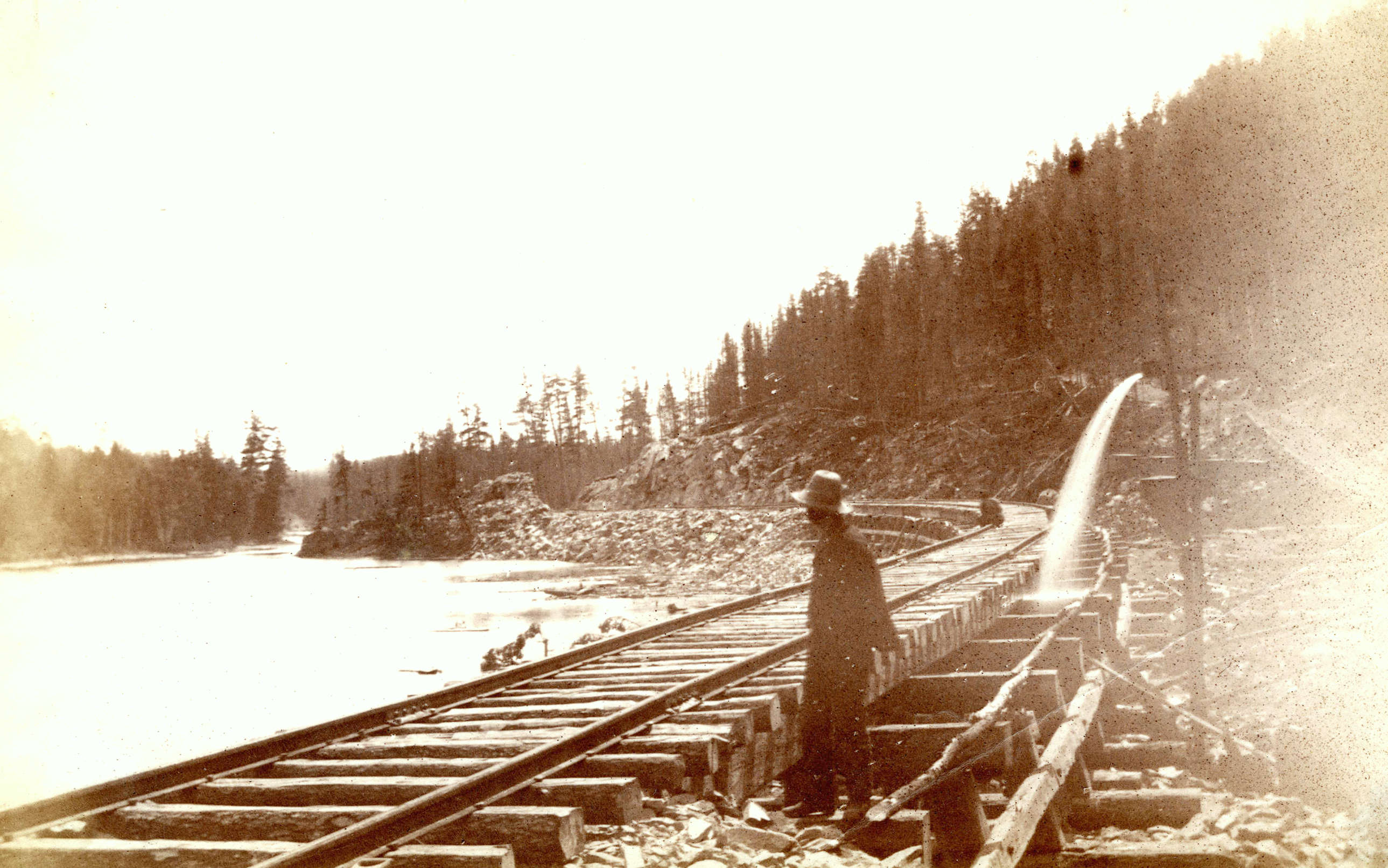
Last spring, John Burger posted on the Historic Northern Ontario Facebook group a number of photos taken by Harry Abbott in 1884 (https://searcharchives.vancouver.ca/abbott-family-fonds). These photos were of several locations during the construction of the Canadian Pacific line through the Lake Pogamasing area, alongside the Spanish River. Abbott was in charge of building the line through the region. It was astonishing to me that he took several shots that I recognized immediately. So this summer I decided to revisit these sites to see how they compared to Abbott’s photos. The bridges in the Pog area, the one seen below over the Spanish River and the second one over the creek that flows from Lake Pogamasing into the Spanish.
Abbott’s photos were taken from two sides of the river. The photo below is from the western side and shows a footbridge over the Spanish River used during construction. To the right of the footbridge, you can see the western abutment.

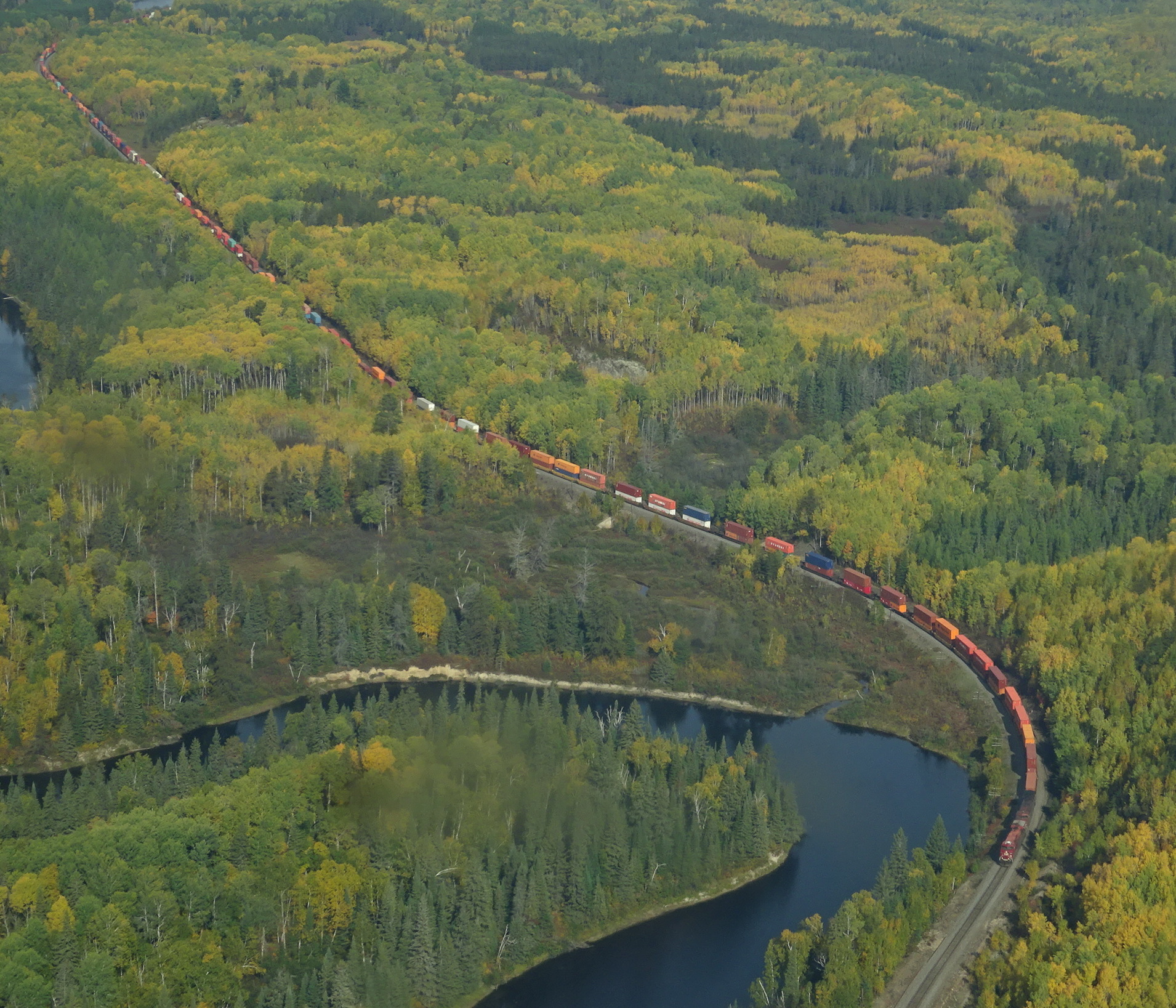
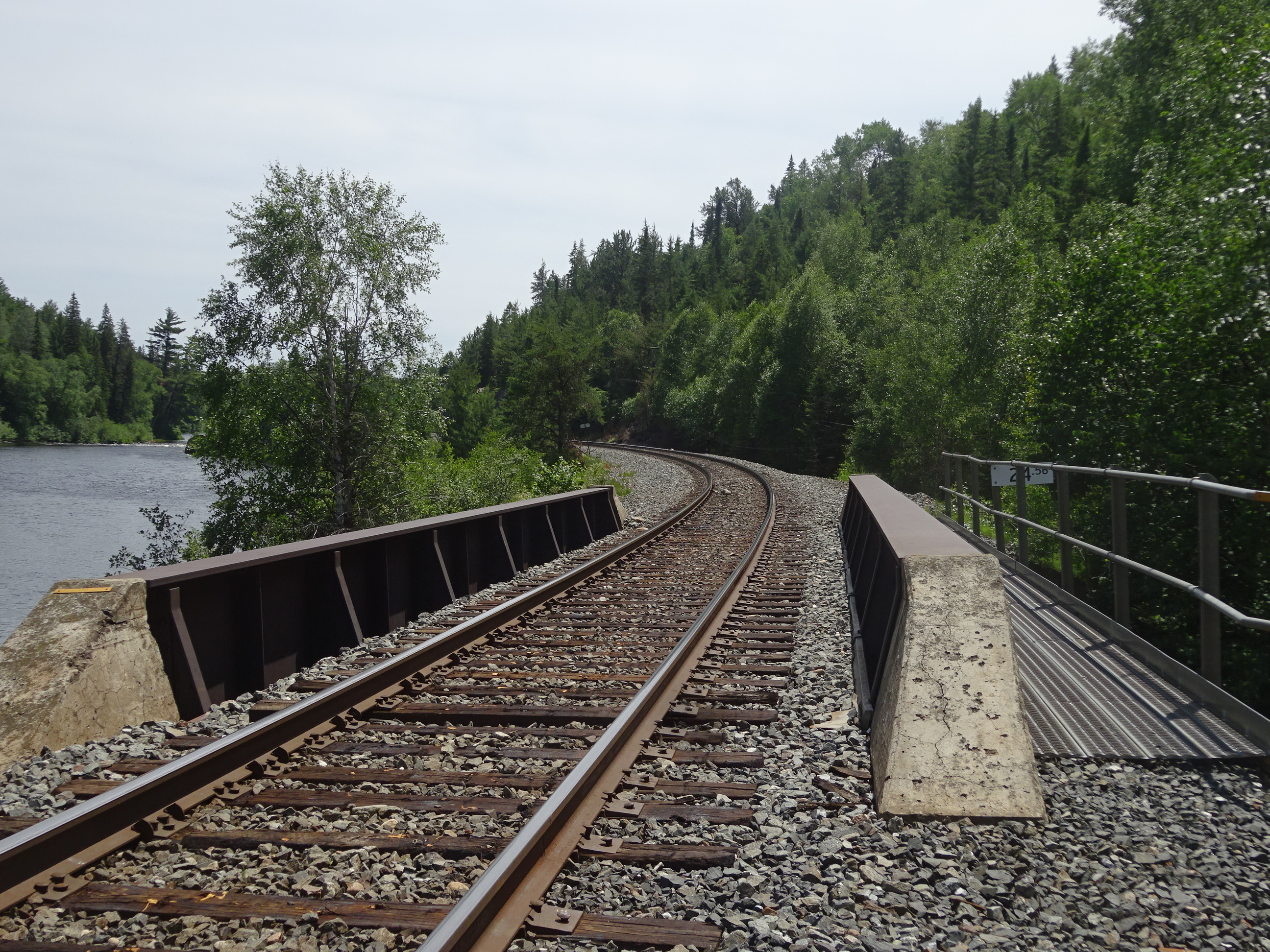
Below, are a few photos I took last summer. The first CP bridges were built with timbers from the area. Once the rail line was completed the construction crews returned and rebuilt the bridges with steel. However, the trains and weight of the engines have increased considerably, so the steel (photos 2 & 3) has also been upgraded to carry the long trains. I witnessed one freight train last summer that consisted of 150 cars, propelled by three diesel engines. What is remarkable is that the stone foundations that were built over 135 years ago still exist, at least to my eyes. As a long-time friend who has an interest in the building of the railway told me: Imagine that those bridges and culverts were designed for the approximately 35 ton 4-4-0 American locos and cars with a capacity of less than about 30 tons and are now supporting diesel locomotives weighing in the neighborhood of 165 tons.
The bridge and rail system today
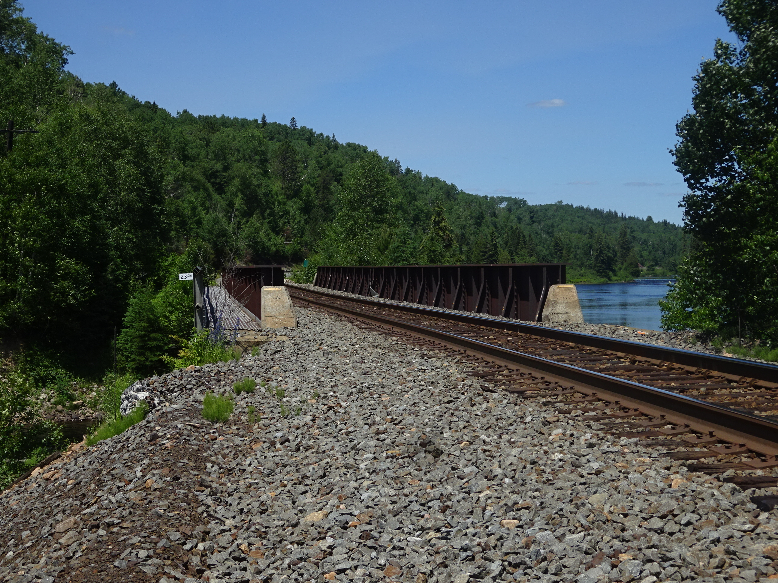
With upgraded steel
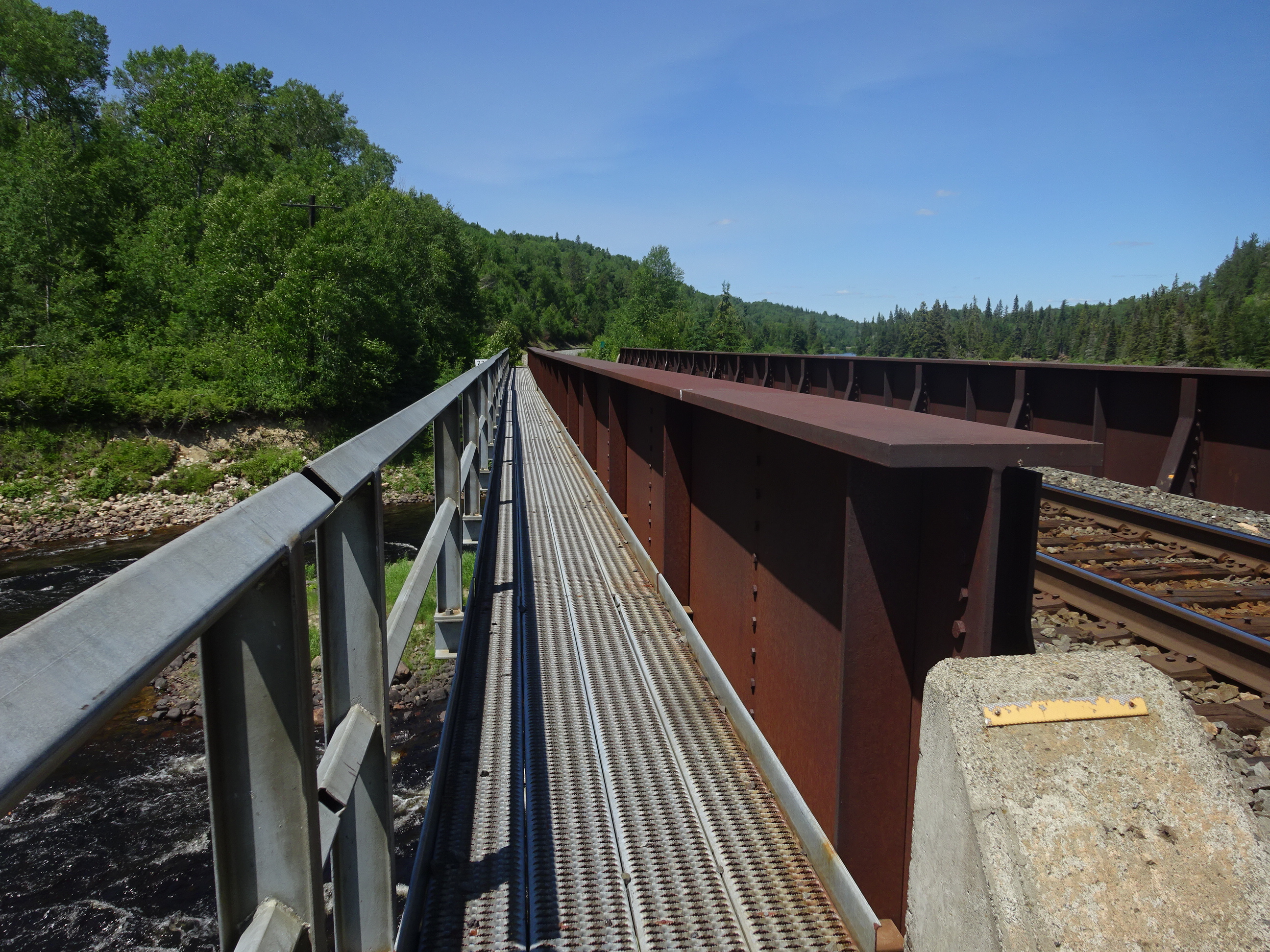
But the same old limestone foundation, as least to my amateur eyes
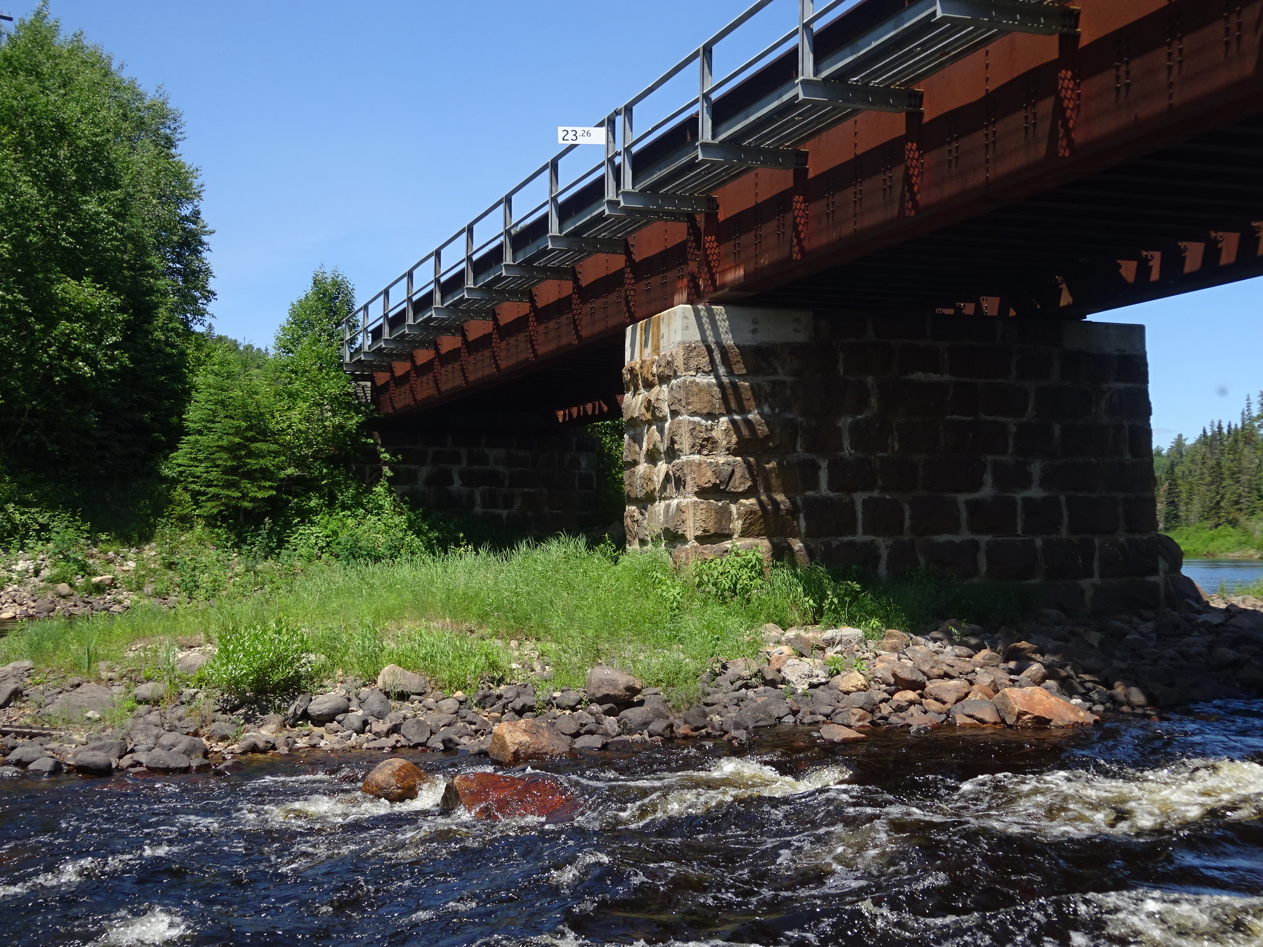
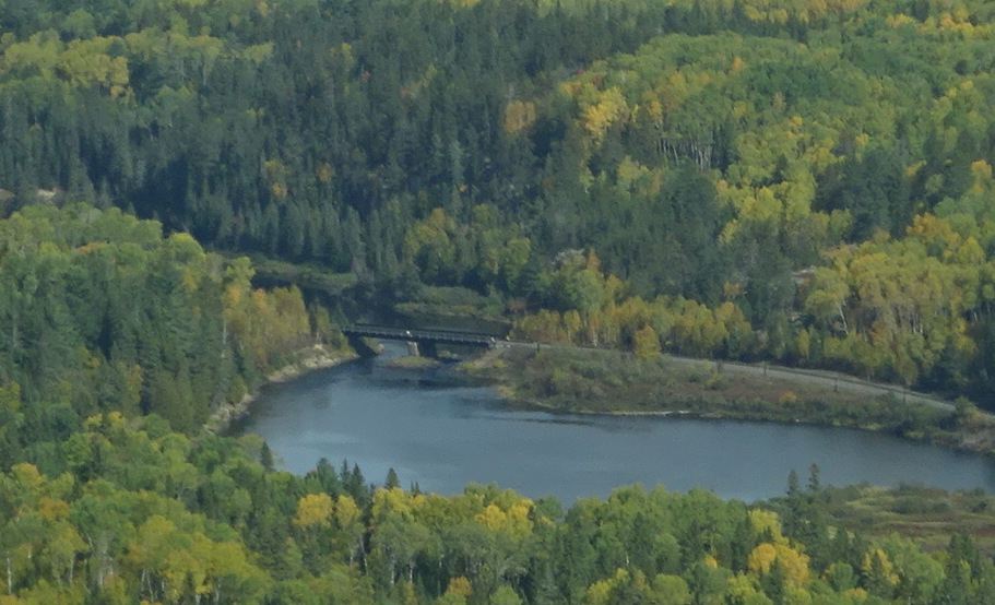
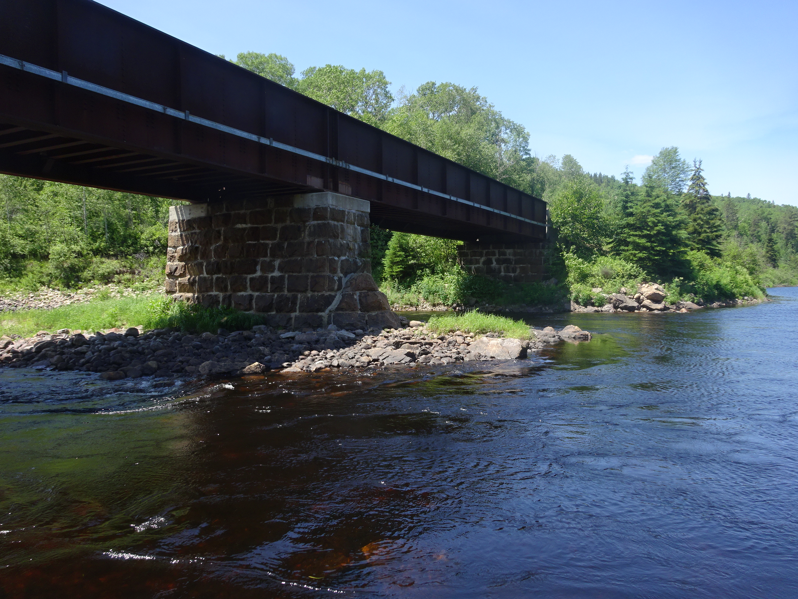
Photo below is from the eastern side of the river. What surprised me when I looked at the bridge was the width of the river appears to be narrower in Abbott’s photos.
The view today of the same location
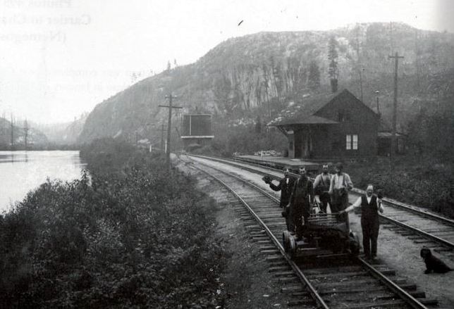
There is an additional sideline to the building of the bridges that had to do with the source of the stone. My above-mentioned friend – he preferred to remain anonymous – thought the limestone came from behind the Pogamasing station (below), as it was only three miles from the river crossing. The stone is the correct colour as opposed to the reddish granite rock near the bridge. Besides, my friend thinks the other quarries were not readily available at this time.
Bridge over Pogamasing Creek
The second bridge is over Pog Creek and was a much shorter span. Underneath the western abutment, I noticed the date in cement: 1908.
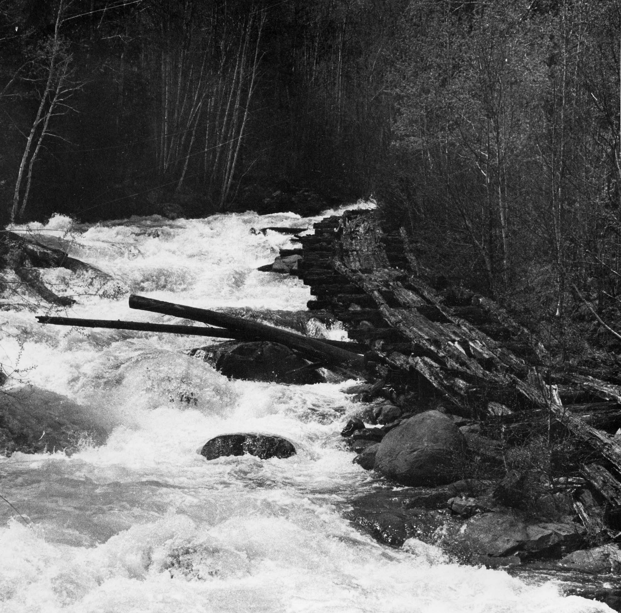
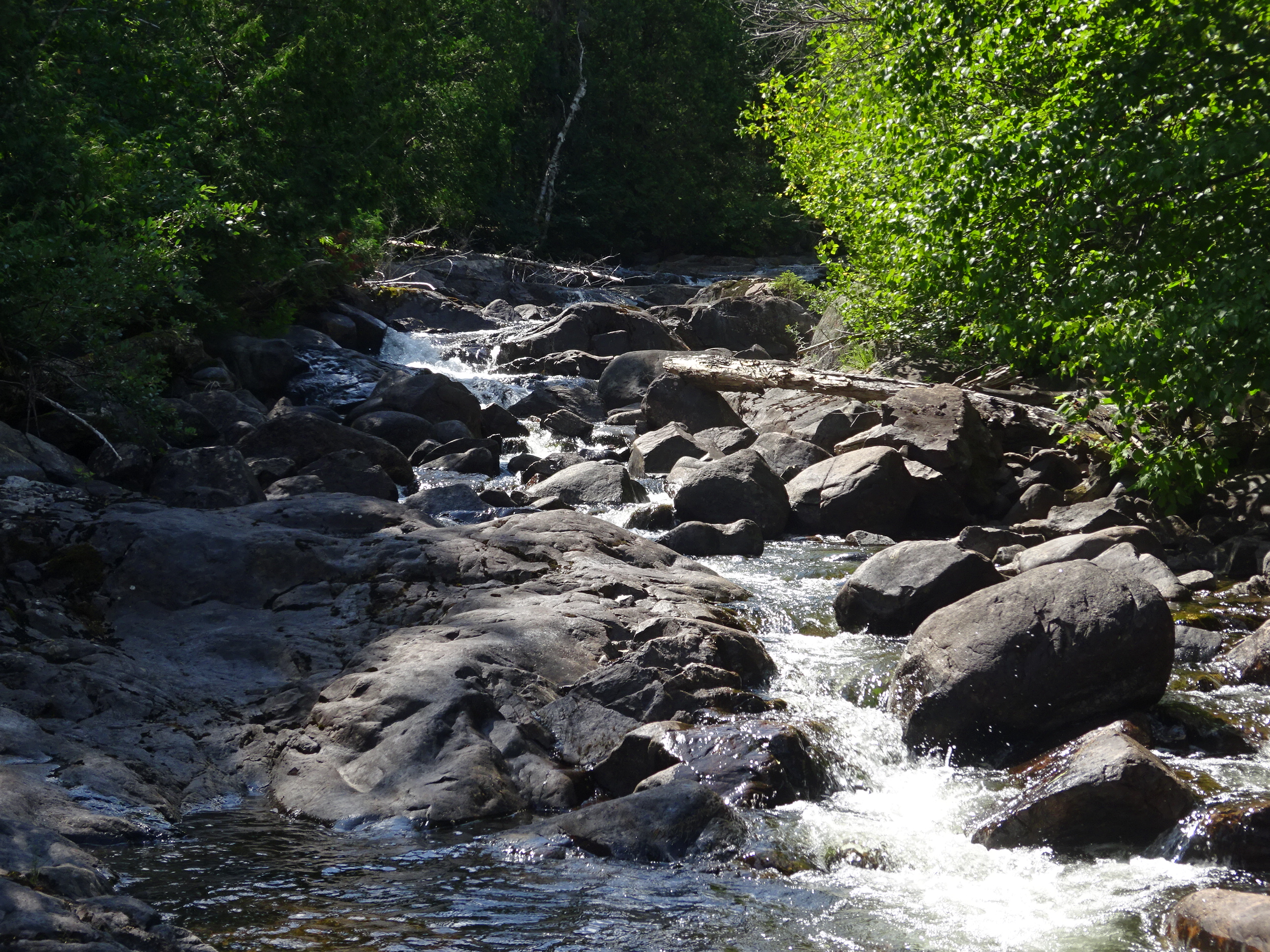
Logging Floom
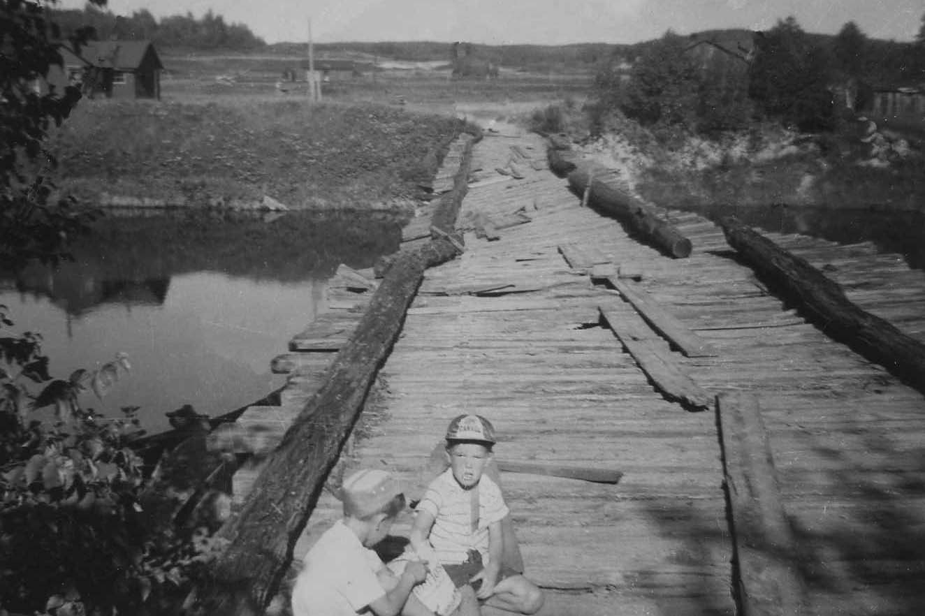
A third structure that existed close by the Pog bridge was a floom that carried the logs down a very rocky section of the creek and under the CP bridge. The floom was rebuilt in 1929 when my grandfather, W. B. PLaunt first came to Pog. He had a crew repair the floom that had been built by either John Charlton or Cleveland and Sarnia, the previous companies that had logged the region. In 1962, I took the photo of what was left and then again, when I was at the bridge this past summer. However, given the nature of the logging business, these structures and all the camps and dams were only built to last a few years.
W. B. Plaunt Bridge over the Spanish at Wye
W. B. Plaunt built the bridge in 1929 to supply his logging camps on Lake Pogamasing and in the interior.
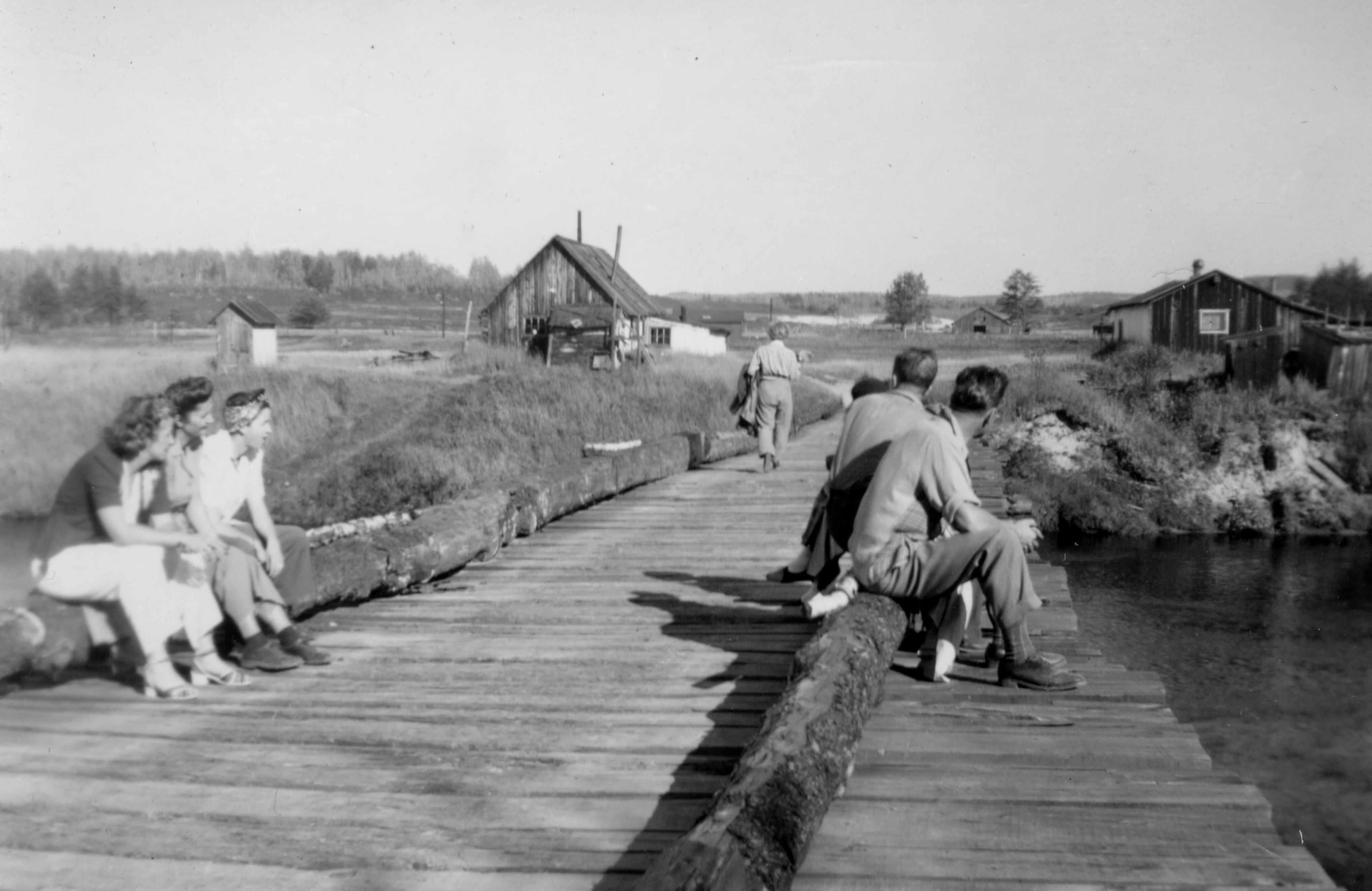
The movement of the spring ice flow began to weaken the central crib and in the spring of 1957, the ice flow carried the failing structure down the Spanish. It was a blessing, as people walked across the bridge with their small children, or rolled gasoline barrels and propane tanks across this very unstable structure.

{ 4 comments… read them below or add one }
I have fished were the 2 rivers meet and the year that the bridge was built is on the stone almost under the bridge. The water gets so high that you can not walk under the bridge, the water rises to just below the bridge right up until mid June at times. We have also walked up to the dam for something to do but it is not a good trail one has to be super careful.
Yes, the water can get quite high but since I haven’t been there in the early spring I’ve never witnessed what you’ve seen.
The path is much better – I walked it three times this past summer and ran into a canoe trip of 8 girls from Wapomeo on one of them – so you may have walked it a few years ago.
Hi Andy
Found these photos quite by chance. Have discovered new family member and was looking at their Facebook and came up with these views of Pog…beautiful scenery…still have to see it for myself!
Greta (Laurie’s sister)
Hi Greta,
Nice to hear from you. Glad you found the photos.I take it you didn’t get to Pog this past summer. It will still be there next year.
Best,
Andy